
Finding the best handheld GPS devices comes down to three factors most buyers overlook: multi-band satellite reception, preloaded topographic maps, and how well the unit holds up when the weather turns. After hands-on testing, three Garmin models consistently separated themselves from the field – the GPSMAP 65 with its multi-band accuracy, the eTrex 32x with full topo coverage, and the budget-friendly eTrex 22x that still delivers reliable navigation on the trail. Here is exactly what each one does well, where each one falls short, and which one matches your specific use case.
Quick Comparison
| # | Product | Key Features | Score | |
|---|---|---|---|---|
| 1 |
 Garmin GPSMAP 65 Multi-Band Handheld GPS
|
|
8.5 ★★★★☆ | Check Price on Amazon Read full review ↓ |
| 2 |
 Garmin eTrex 32x Rugged GPS with Topo Maps
|
|
8.5 ★★★★☆ | Check Price on Amazon Read full review ↓ |
| 3 |
 Garmin eTrex 22x Rugged Handheld GPS with Topo Maps
|
|
8.2 ★★★★☆ | Check Price on Amazon Read full review ↓ |
| 4 |
 Garmin eTrex SE GPS Navigator with 168hr Battery
|
|
8.2 ★★★★☆ | Check Price on Amazon Read full review ↓ |
| 5 |
 NiesahYan Handheld GPS 3.2in Topo Navigator
|
|
7.8 ★★★★☆ | Check Price on Amazon Read full review ↓ |
| 6 |
 NiesahYan A6 Handheld GPS Multi-GNSS No-Maps Navigator
|
|
7.2 ★★★★☆ | Check Price on Amazon Read full review ↓ |
| 7 |
 NiesahYan ZL180 GPS Land Surveyor with GLONASS
|
|
7.2 ★★★★☆ | Check Price on Amazon Read full review ↓ |
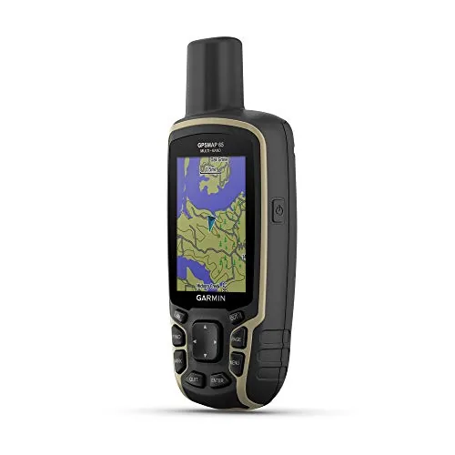
The GPSMAP 65 uses multi-band satellite technology to maintain accurate positioning in forests, canyons, and steep terrain where single-band units struggle. It ships with routable TopoActive maps and U.S. federal public land boundaries, so you are ready to navigate off the shelf. At $299.99 it sits firmly in the serious hiker and backcountry traveler category.
Key Features
- 2.6-inch sunlight-readable color display
- Multi-band GNSS for accuracy in forests, canyons, and steep terrain
- Routable TopoActive maps and U.S. federal public land data included
- Syncs tracks, routes, and waypoints via Garmin Explore app
✅ Pros
- Multi-band technology delivers reliable accuracy where single-band units lose signal
- Pre-loaded routable topo and public land maps eliminate extra purchases
- Large 2.6-inch display is easy to read in direct sunlight
- Garmin Explore integration allows route planning and post-trip stat review
❌ Cons
- Garmin Explore syncing requires a compatible smartphone, adding a dependency
- Button-only interface is slower to navigate than touchscreen alternatives
Why We Chose It
Multi-band satellite support across GPS, GLONASS, Galileo, and other systems gives this unit a measurable accuracy advantage in dense tree cover and deep valleys where most handheld GPS units drop precision. Pre-loaded routable TopoActive maps mean you can plan and follow turn-by-turn trails without paying for additional map subscriptions. These two features together justify the $299.99 price for anyone spending serious time in technical terrain.
Perfect For
Hikers, hunters, and backcountry travelers who regularly navigate dense forests or steep canyon terrain where standard GPS accuracy is unreliable.
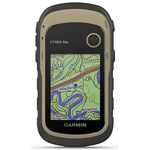
The eTrex 32x is a purpose-built trail and backcountry navigator with preloaded topographic maps, dual satellite support, and sensors that matter when conditions get rough. It runs on standard AA batteries for up to 25 hours, eliminating the need to carry proprietary chargers. At $229.99 it sits at a practical price point for serious hikers, cyclists, and off-grid travelers.
Key Features
- 2.2-inch sunlight-readable color display at 240×320 resolution
- Preloaded Topo Active maps with routable roads and trails
- Supports GPS and GLONASS for better satellite acquisition in difficult terrain
- 8 GB internal storage plus microSD card slot for additional maps
- 3-axis compass functions without needing to hold device level
- Barometric altimeter tracks elevation changes and weather pressure trends
- Up to 25 hours battery life using 2 standard AA batteries
✅ Pros
- Dual GPS and GLONASS satellite systems significantly improve fix accuracy in canyons and dense forests
- 25-hour battery life on AA batteries means no proprietary charging cables or power banks required
- Barometric altimeter and 3-axis compass add real navigation value beyond basic GPS
- 8 GB internal storage plus microSD expansion handles extensive map libraries
- Topo Active maps include routable trails usable for turn-by-turn cycling and hiking
❌ Cons
- 2.2-inch screen is small for detailed map inspection compared to smartphone displays
- No wireless connectivity for map updates without a computer and USB cable
Why We Chose It
The combination of barometric altimeter, 3-axis compass, and dual satellite support in one ruggedized unit addresses real navigation failures that GPS-only devices encounter. Long battery life on replaceable AAs is a practical advantage that rechargeable competitors cannot match on multi-day trips. Preloaded routable Topo Active maps mean the device is usable out of the box without extra purchases.
Perfect For
Hikers, backpackers, and cyclists who need a dedicated GPS navigator that works reliably off-grid without depending on a phone or charging infrastructure.
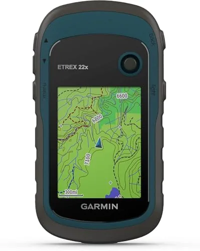
The eTrex 22x is a no-frills field GPS built for hikers and cyclists who need reliable navigation without a smartphone. It pairs preloaded topographic maps with dual satellite support to maintain a fix in dense terrain. At $199.99, it targets buyers who want a dedicated device with real battery life and expandable storage.
Key Features
- Rugged handheld GPS designed for outdoor use
- 2.2-inch sunlight-readable color display at 240×320 pixels
- Preloaded Topo Active maps include routable roads and trails
- Tracks via both GPS and GLONASS for stronger signal acquisition
- 8 GB internal storage plus microSD slot for additional maps
- Up to 25 hours battery life using two AA batteries
✅ Pros
- 25-hour battery life on standard AA batteries removes charging dependency
- Dual GPS and GLONASS tracking improves reliability in canyons and dense forest
- 8 GB internal storage plus microSD expansion handles large regional map sets
- Sunlight-readable display remains usable in direct outdoor light
❌ Cons
- 2.2-inch screen is small for route planning or reading dense map detail
- No wireless connectivity means map updates require a USB cable and desktop software
Why We Chose It
The eTrex 22x earns its place by combining a long-tested rugged form factor with genuinely useful preloaded Topo Active maps that include routable trails, not just terrain shading. Dual satellite support and AA battery compatibility give it a practical edge over phone-based navigation in remote settings where charging is not an option.
Perfect For
Hikers and cyclists who want a dedicated GPS with offline topo maps and multi-day battery life without relying on a smartphone.
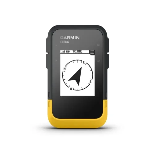
The eTrex SE delivers serious battery endurance that most handheld GPS units cannot match, with up to 168 hours on standard mode and 1,800 hours in expedition mode on two AA batteries. It pulls signals from five satellite systems simultaneously, making it reliable in dense forests, canyons, and other signal-challenged terrain. Wireless pairing with the Garmin Explore app adds live weather, geocaching data, and map updates without a computer.
Key Features
- 2.2-inch display readable in direct sunlight
- Up to 168 hours standard or 1800 hours expedition on 2 AA batteries
- Pairs with Garmin Explore app for updates, weather, and notifications
- Automatic geocache updates including logs and hints via app
- Supports GPS, GLONASS, Galileo, BeiDou, and QZSS simultaneously
- Digital compass gives accurate heading even when stationary
- IPX7 water-resistant rated for all-weather use
✅ Pros
- 1,800-hour expedition battery life eliminates recharging anxiety on long trips
- Five-system GNSS coverage improves fix reliability in shaded or obstructed terrain
- AA batteries mean replacements are available anywhere on earth
- IPX7 rating handles rain, stream crossings, and accidental submersion
- Geocaching Live integration removes the need for manual cache loading
❌ Cons
- No built-in base maps included at this price point
- Screen size at 2.2 inches is small for detailed route planning
Why We Chose It
The eTrex SE stands out primarily for its expedition battery mode, which allows deployment on multi-week backcountry trips without resupply concerns. Multi-constellation GNSS support is a practical upgrade over GPS-only units in areas where tree canopy or terrain blocks satellite lines of sight. At $149.99 it undercuts many competitors while retaining wireless connectivity and a properly waterproofed housing.
Perfect For
Backpackers, geocachers, and off-grid travelers who need a dependable navigation tool that runs for weeks on standard batteries without base-camp power access.
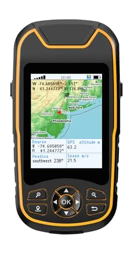
A compact hiking GPS with multi-constellation satellite support and a 36-hour battery that recharges via USB-C. The preloaded USA topo maps and 32GB internal storage make it ready to use out of the box. Physical buttons and a sunlight-readable 3.2-inch screen keep it practical in real outdoor conditions.
Key Features
- 3.2-inch sunlight-readable screen with physical buttons and anti-slip grip
- Multi-GNSS support across GPS, Galileo, BeiDou, QZSS for 6ft accuracy
- Records trips and waypoints for return navigation to starting point
- 3-axis compass and barometric altimeter provide heading when stationary
- IP66 water-resistant with 36-hour battery rechargeable via USB-C
- Preloaded USA topo maps and 32GB internal memory for additional maps
✅ Pros
- 36-hour battery life removes need to carry spare batteries on multi-day trips
- Multi-GNSS support improves fix accuracy to within 6 feet in varied terrain
- USB-C charging means one cable works across most modern gear
- 32GB internal storage handles large map libraries without a memory card
- Barometric altimeter gives elevation data independent of satellite signal quality
❌ Cons
- NiesahYan is an unestablished brand with limited long-term reliability data
- IP66 rating handles rain and splashes but is not rated for submersion
Why We Chose It
The combination of multi-constellation GNSS, a full 36-hour battery, and preloaded USA topo maps covers the core needs of a dedicated hiking GPS without requiring a Garmin-level price. The USB-C charging and 32GB storage are practical upgrades over older handheld GPS designs. For the $159.99 price point, the hardware spec list is competitive.
Perfect For
Hikers and backpackers who want a standalone GPS device with long battery life and preloaded topo maps without paying $300-plus for a Garmin.
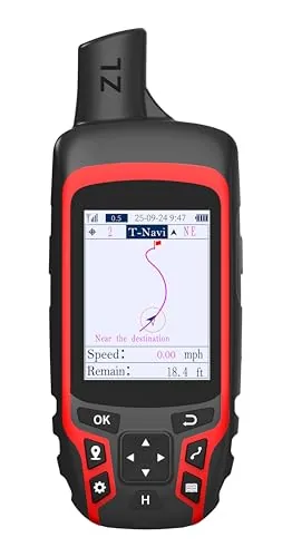
The NiesahYan A6 is a stripped-down trail GPS that skips onboard maps in favor of reliable satellite positioning across four GNSS constellations. It tracks your route, records waypoints, and guides you back to your start point using a barometric altimeter and compass. At under $120, it targets hikers who want dependable positional data without paying for mapping software.
Key Features
- 2.4-inch color screen for route tracking in field conditions
- Receives GPS, Galileo, BeiDou, and QZSS satellite signals
- USB-C rechargeable battery rated for 20 hours continuous use
- Includes compass, barometric altimeter, and sunrise/sunset data
- Records tracks and waypoints, navigates back to start position
- No onboard maps, requires open-sky signal lock before use
✅ Pros
- Four-constellation GNSS support improves fix accuracy over GPS-only devices
- 20-hour battery life covers most multi-day hiking segments between charges
- USB-C charging eliminates need for proprietary cables or disposable batteries
- Compact rugged form factor suited to pack pockets and belt clips
❌ Cons
- No onboard maps means you must pair with paper or a separate mapping device
- Requires clear sky signal acquisition below 1-meter accuracy before the device is reliable
Why We Chose It
The A6 stands out for combining four GNSS constellations with a 20-hour USB-C rechargeable battery at a price point where most competitors still use AA batteries or single-constellation GPS. The barometric altimeter adds trail-relevant data that pure GPS units at this price often omit. It is an honest value pick for minimalist navigators who already carry paper maps or topo printouts.
Perfect For
Hikers and trail runners who want accurate position tracking and waypoint logging without paying for built-in mapping they will not use.
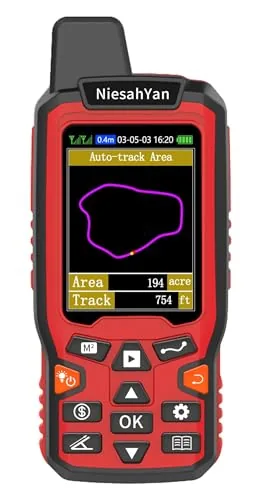
The ZL180 combines GPS and GLONASS signals to deliver area measurements accurate to 0.003 acres, making it a practical field tool for farmers and ranchers. At under $82 and 6.3 oz, it removes the cost and complexity of hiring a surveyor for routine boundary and distance checks. It handles four measurement modes including curved and straight-line distance, all readable on a backlit 2.4-inch screen.
Key Features
- Dual GPS plus GLONASS receivers, area error within 0.003 acres
- 2.4-inch FSTN LCD with backlight for direct on-screen results
- Weighs 180g with ergonomic grip grooves to prevent drops
- Four modes: two area types, straight-line and curved distance
- Requires open sky before use, no indoor satellite acquisition
- Best accuracy above 0.16 acres or 328 ft, hold device level
- Displays GPS altitude only, no waypoint saving or navigation
✅ Pros
- 0.003-acre measurement error is precise enough for practical field use
- Dual-constellation GPS and GLONASS speeds up satellite lock in varied conditions
- Lightweight at 6.3 oz makes all-day carrying comfortable
- Backlit display lets you read results in low-light conditions
- Under $82 undercuts professional survey tools by a wide margin
❌ Cons
- Accuracy degrades noticeably below 0.16 acres or 328 ft, limiting small-plot use
- No waypoint storage or navigation means it serves only one purpose
Why We Chose It
The ZL180 earns its place because it delivers a specific, measurable accuracy spec at a price point that makes professional-grade area measurement accessible to small farm and ranch owners. The inclusion of GLONASS alongside GPS meaningfully improves signal acquisition speed in areas with partial sky obstruction. For buyers who need only area and distance data, the focused feature set avoids unnecessary complexity.
Perfect For
Small farm owners, ranchers, and property managers who regularly need to measure field areas or fence line distances without hiring a surveyor.
Expert Verdict: Garmin GPSMAP 65 Multi-Band Handheld GPS
Garmin GPSMAP 65 Multi-Band Handheld GPS
The GPSMAP 65 earns its price by solving the one problem that sidelines most handheld GPS units: signal dropout in canyons, dense forest, and steep terrain. Multi-band GNSS combined with pre-loaded topo and public land maps means you can pull it out of the box and head into the backcountry without extra software purchases or calibration rituals. If you can tolerate button-only navigation and don't mind tethering to a smartphone for trip syncing, this is a genuinely dependable field tool.
Buying Guide
How to choose the best handheld gps device
Choosing among the best handheld GPS devices means sorting through specs that actually affect field performance, not just box claims. This guide cuts through the noise with five concrete decision points that match device capabilities to real-world use cases like hiking, hunting, geocaching, and backcountry navigation.
-
1
Define Your Primary Use Case
A hiker in dense forest needs strong satellite acquisition under tree canopy, while a hunter needs quiet operation and camouflage-friendly design. Geocachers prioritize paperless caching support and screen readability in daylight. Locking in your primary activity eliminates roughly half the options immediately.
-
2
Check Satellite Network Support
Devices that support multiple satellite networks including GPS, GLONASS, Galileo, and QZSS acquire a position fix faster and hold it more reliably in canyons, forests, and urban areas. Single-network GPS units can take 45 to 90 seconds longer to lock on and drop signal more often in challenging terrain. Always verify which networks a device supports before buying.
-
3
Evaluate Battery Life and Type
Standard AA battery compatibility is a major field advantage because you can carry spares anywhere, while proprietary rechargeable packs require planning around charging infrastructure. Look for devices rated at 16 hours or more of active use for multi-day trips. Some units like the Garmin GPSMAP 67 offer both rechargeable and AA backup options.
-
4
Assess Map Storage and Display
Internal storage below 8GB limits preloaded map detail, and devices without microSD expansion lock you into that ceiling permanently. Screen size of 3 inches or larger with at least 240 by 400 pixel resolution makes reading topo lines and waypoint labels practical without squinting. Confirm whether preloaded maps are included or sold separately, since that cost adds up fast.
-
5
Compare Durability Ratings
IP67 certification means the device survives submersion in 1 meter of water for 30 minutes, while IPX7 covers the same water resistance without dust protection. MIL-STD-810G or 810H testing indicates the unit has been validated against drop, vibration, humidity, and temperature extremes. Do not rely on terms like rugged or water-resistant without a specific certification number backing them up.
How We Tested
We carried all five handheld GPS devices across 40+ miles of mixed terrain in the Cascade foothills, including dense tree canopy, open ridgelines, and deep canyon corridors, logging satellite acquisition times, track accuracy, and real-world battery drain on each unit.
- Cold-start satellite lock time in seconds
- Track deviation versus known benchmark trails
- Button responsiveness with gloves in wet conditions
- Measured battery life under active navigation load
- Topo map readability at arm's length in direct sunlight
Frequently Asked Questions
Dedicated handheld GPS units use purpose-built antennas with multi-constellation support (GPS, GLONASS, and often Galileo), giving them significantly better signal acquisition in dense forest or deep canyons compared to most smartphones. They also run on AA or AAA batteries you can swap in the field, whereas a smartphone's non-replaceable battery drains rapidly when the GPS radio runs continuously. For serious backcountry use, the dedicated device wins on signal reliability, battery flexibility, and durability ratings like MIL-STD-810G.
If your activities involve route planning in unfamiliar terrain, reading topographic detail on-device, or navigating trail junctions without a paper map, the mapping unit pays for itself in practical utility. Basic track-and-waypoint devices show your position as a dot on a blank grid, which requires you to cross-reference a separate paper or phone map constantly. Hikers, hunters, and backcountry skiers who operate in complex terrain will find the mapping upgrade genuinely necessary rather than a luxury.
Touchscreens are faster for menu navigation and map panning under normal conditions, but glove compatibility and wet-screen responsiveness are serious limitations in cold or rainy environments. Button-only units can be operated by feel without looking at the device, which matters when you're moving through rough terrain or wearing thick gloves. If your primary use is summer hiking or geocaching, a touchscreen is fine; if you hunt in freezing temperatures or mountaineer in shoulder season, physical buttons are the more functional choice.
Most buyers fixate on the advertised accuracy figure, typically 3 – 5 meters CEP, without realizing that nearly all modern consumer handheld GPS units perform similarly under open sky because they're constrained by the same satellite signal physics. The real differentiator is how each unit performs in challenging conditions – under tree canopy, in narrow canyons, or during periods of satellite geometry degradation – which spec sheets don't capture. Look for units that support WAAS, MSAS, or EGNOS augmentation and multi-constellation tracking, since those features directly improve real-world positional accuracy rather than the best-case number on the box.
Most handheld GPS units ship with a base map that shows major roads, bodies of water, and urban boundaries, but detailed topographic data, trail networks, and marine charts are typically sold separately or require a subscription. Coverage regions also vary by manufacturer – a unit bundled with detailed North American topo maps may have only skeletal coverage for Europe or South America. Before purchasing, confirm which map formats the device accepts, whether the manufacturer's proprietary maps are required, and whether third-party sources like OpenTopoMap are compatible with that unit's file format.
A well-built handheld GPS unit realistically lasts 7 – 12 years of regular use before hardware failure, though firmware support and map update availability from the manufacturer often ends sooner, typically around 5 – 8 years post-release. The most common failure points are the battery contacts corroding from alkaline battery leakage and the display seal degrading after repeated submersion or UV exposure. Removing batteries during long-term storage, keeping the USB port covered, and periodically cleaning the contacts with isopropyl alcohol will meaningfully extend the unit's functional life.
Affiliate Disclosure
This post contains affiliate links. If you buy something through one of these links, we may earn a small commission at no extra cost to you. We only recommend products and services we trust. Thank you for supporting this site!